Gopherus agassizii (Cooper 1861) –
Mojave Desert Tortoise, Agassiz’s Desert Tortoise
Kristin H. Berry1 and Robert W. Murphy2
1U.S. Geological Survey, 21803 Cactus Avenue, Suite F,
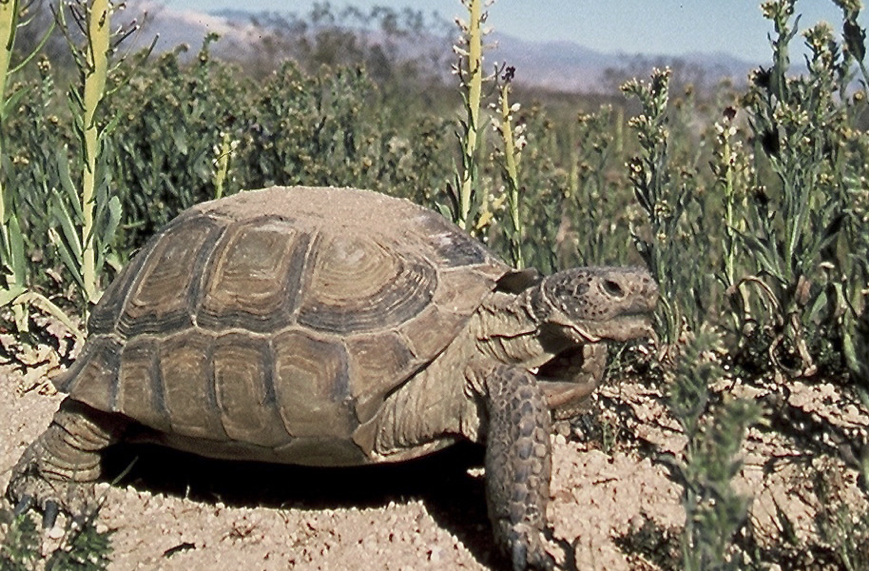
Summary. – The Mojave Desert Tortoise, Gopherus agassizii (Family Testudinidae), is a large terrestrial species that can reach >370 mm in straight midline carapace length (CL) but most individuals are smaller. Both sexes reach adulthood at 12 to 21 years and ca. 180 mm CL. The species is sexually dimorphic, with males typically larger than females; sexual characteristics of males become more obvious with increasing size and age. Females lay from 1 to 10 eggs per clutch and from 0 to 3 clutches annually, with eggs hatching after 67 to 104 days. Populations of G. agassizii have declined rapidly over the last several decades. Habitat throughout the geographic range has experienced major losses, degradation, and fragmentation as a result of urban and agricultural development, livestock grazing, military activities, transportation and utility corridors, high levels of visitor use, vehicle-oriented recreation, and energy development. Disturbed habitats were vulnerable to invading non-native grasses and forbs, creating an unnatural and destructive grass-fire cycle. When consumed by tortoises as their only diet, non-native (and native) grasses are harmful because of limited nutrients. Additionally, subsidized predators (Common Ravens, Coyotes, and dogs), infectious diseases, drought, and vandalism, add to the catastrophic effects of habitat loss and degradation. Tortoise populations have declined rapidly in density, and most populations are below viability, with fewer than 3.9 adults/km2. These declines occurred despite protections afforded by federal and state laws and regulations, ca. 26,000 km2 of federally designated critical habitat units, two Recovery Plans, and efforts to reduce the negative impacts of human activities. As noted by Allison and McLuckie (2018), the negative population trends in most of the critical habitat units suggest that under current conditions G. agassizii is on the path to extinction.
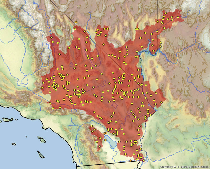
Distribution. – USA. Distributed in parts of the southern Great Basin, Mojave, and western Sonoran deserts in southeastern California, southern Nevada, northwestern Arizona, and southwestern Utah, north and west of the Grand Canyon/Colorado River complex, with the exception of a small population east of the Colorado River.
Synonymy. – Xerobates agassizii Cooper 1861, Testudo agassizii, Gopherus agassizii, Gopherus polyphemus agassizii, Scaptochelys agassizii, Xerobates lepidocephalus Ottley and Velázques Solis 1989.
Subspecies. – None currently recognized.
Status. – IUCN 2019 Red List:
Vulnerable (VU A1acde+2cde; assessed 1996); TFTSG Provisional Red List: Critically Endangered (CR; assessed 2011, 2018); CITES: Appendix II (Testudinidae spp.); US ESA: Threatened.