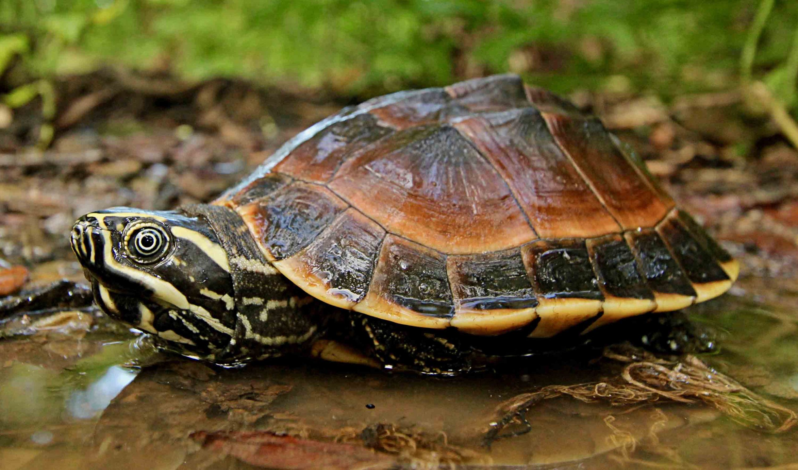
Adult Malayemys subtrijuga from Tonle Sap Lake Biosphere Reserve, Battambang Province, Cambodia.
Photo by Flora Ihlow.
Summary
The Mekong Snail-eating Turtle, Malayemys subtrijuga (family Geoemydidae), is a small (carapace length typically under 200 mm, but reaching up to 236 mm) freshwater turtle inhabiting wetlands, rice fields, and other seasonal lowland habitats in Southeast Asia. The species has an unusual distribution: a disjunct population on the island of Java in Indonesia, which could be either a centuries-old anthropogenic introduction or a naturally occurring relict, and an extensive occurrence across the lower Mekong River drainage of the southeastern Indochinese Peninsula. The species exhibits sexual dimorphism in body size, with females growing considerably larger than males. Individuals have enlarged heads and other specializations for a diet consisting largely of molluscs. Clutches of up to 10 eggs are laid during the dry season (December–March in Cambodia), and incubation is timed so that hatchlings emerge at the beginning of the wet season. Many aspects of the species' natural history remain poorly known. Although considerable habitat is available, populations throughout the species' distributional range appear to have declined as a result of exploitation. Reduction in the level of collection and additional research and management are needed for the conservation of this species.
Distribution
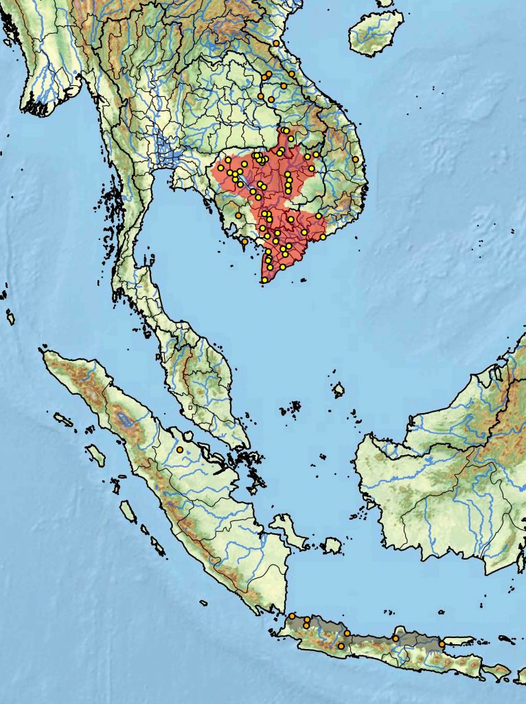
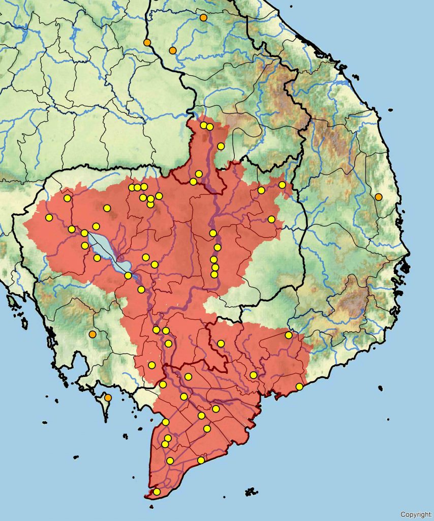
Cambodia, Indonesia, Laos, and Vietnam. An isolated population is present on the Indonesian island of Java. The species occurs in lowland areas throughout Cambodia, southern Laos, and southern Vietnam.
Distribution of Malayemys subtrijuga in left: Southeast Asia (Laos, Cambodia, Vietnam, and Java, Indonesia) and right: detailed view of Indochinese Peninsula (Laos, Cambodia, and Vietnam). Yellow dots = museum and literature occurrence records of native populations based on Iverson (1992) plus more recent and authors' data; orange dots = uncertain native, introduced, misidentified, or trade specimens; red shading = presumed native historic indigenous range; gray shading = possibly historically introduced populations. Distribution based on GIS-defined level 12 HUCs (hydrologic unit compartments) constructed around verified localities and then adding HUCs that connect known point localities in the same watershed or physiographic region, and similar habitats and elevations as verified HUCs (Buhlmann et al. 2009; TTWG 2017, in press), and adjusted based on authors' subsequent data.